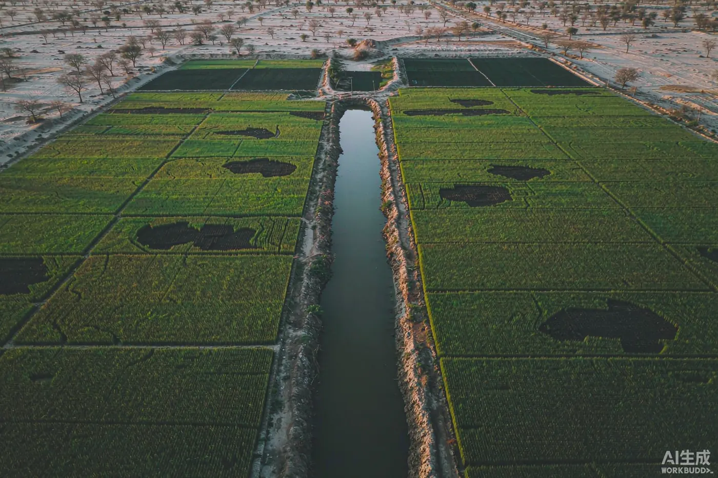
Vehari District lies in Pakistan's Punjab province, along the right bank of the Sutlej River, which forms its southern boundary. It is a canal-irrigated agricultural district of just over 4,300 square kilometres, and in recent years its maize sector has expanded faster than almost any comparable indicator in the region.
The headline data
Two figures define the district's recent agricultural story: maize acreage and maize production. Both roughly doubled within four years.
| Indicator | 2015–16 | 2019–20 | Change |
|---|
| Maize acreage | 141,000 acres | 309,000 acres | +119% |
| Maize production | 428,000 tonnes | ~1,100,000 tonnes | +157% |
Two things are worth reading carefully here.
First, production grew faster than acreage — 157% against 119%. That gap means yields per acre improved over the period, not merely that more land was planted. Roughly: 428,000 tonnes over 141,000 acres works out to about 3.0 tonnes per acre, while 1.1 million tonnes over 309,000 acres is about 3.6 tonnes per acre. An increase of around 20% in productivity per unit of land.
Second, the absolute scale is large. A district producing more than a million tonnes of maize a year is moving a significant volume of physical product through storage, transport and processing every season.
Why the district can support this
The answer is water. Vehari's agriculture exists because of canal irrigation, and the pattern of settlement in the district was created by it.
In the Burewala area specifically — the district's largest city and one of its four tehsils — the land was jungle before the Pakpattan Canal was put into operation. Once canal water arrived, villagers cleared the jungle for cultivation and new settlements were established. The area was administratively designated village no. 118/EB of the Eastern Canal Division.
The Pakpattan Canal itself is an irrigation canal in central Punjab, extracted from the Sulemanki Headworks and named after the city of Pakpattan. Alongside it, the broader link-canal system — including the P.I. Link canal — still moves water through the district today.
Physical trace
In the northern part of Burewala Tehsil, remains of an old water canal survive, now known as Sukh Bias — a visible remnant of the irrigation works that preceded the modern network.
The district in numbers
For anyone assessing Vehari as a market, the demographic profile matters as much as the farm data. All figures below are from the 2023 census.
| Indicator | Value |
|---|
| Population | 3,430,421 |
| Households | 543,036 |
| Area | 4,364 km² (1,685 mi²) |
| Urban population | 782,915 — 22.82% |
| Under 10 years of age | 940,756 — 27.44% |
| Sex ratio | 102.33 males per 100 females |
| Literacy rate | 59.10% |
| — male literacy | 66.43% |
| — female literacy | 51.57% |
Three observations that bear on commercial decisions:
- It is a young population. More than a quarter of residents are under ten. Over the coming two decades this cohort enters the workforce — relevant for labour supply and for consumer demand.
- It is overwhelmingly rural. Only 22.82% live in urban areas, which means distribution to this market is fundamentally a rural logistics problem, not a city-retail one.
- Literacy is below the national conversation but improving. At 59.10% overall the district sits well behind Pakistan's urban centres; the 15-point gap between male and female literacy (66.43% vs 51.57%) is the more striking figure.
Languages and how business is done
Language shapes how you reach this market. Across Vehari District, 74.10% speak Punjabi as a first language, 19.12% Saraiki, and 5.83% Urdu. In Burewala city specifically, Punjabi rises to 94.03% with Urdu at 5.30%.
The practical implication: English-language marketing will reach only a thin slice of this district directly. Urdu is the working language of formal commerce and government; Punjabi is the language of the farm gate. Serious agricultural outreach here needs Urdu at minimum, and ideally a Punjabi-speaking local partner.
Geography and access
Vehari District lies between 29°36′N 71°44′E and 30°22′N 72°53′E. It borders Bahawalnagar and Bahawalpur to the south, Pakpattan to the east, Khanewal and Lodhran to the west, and Sahiwal and Khanewal to the north. The district is approximately 93 km long and 47 km wide, sloping gently from northeast to southwest.
Burewala, the district's largest city, sits on the Delhi–Multan Road — a long-established north–south corridor through Punjab. The district is divided into four tehsils: Vehari (the district capital), Burewala (the largest city), Jallah Jeem (the third largest), and Mailsi.
Vehari District was created on 1 July 1976, carved out of four tehsils of Multan District. The name Vehari means "low-lying settlement by a flood water channel" — a name that describes exactly the geography the district's agriculture depends on.
What this means for agri-business
Reading the data together, Vehari presents a specific kind of commercial opportunity.
Inputs
Seed, fertiliser, crop protection
309,000 acres under maize alone, plus cotton and wheat, is a large recurring input market. The constraint is distribution: reaching rural customers across a district that is 77% rural.
Machinery
Equipment and mechanisation
Rising yields imply investment in mechanisation and improved practice. Maize at scale needs planting, harvesting and handling equipment that smaller holdings often lack.
Post-harvest
Storage, drying, logistics
Over a million tonnes of maize per year must be dried, stored and moved. Post-harvest capacity is frequently the bottleneck in districts expanding this quickly.
Trade
Aggregation and offtake
Volume production supports aggregation, processing and offtake arrangements — including for the livestock feed sector, which is the principal domestic consumer of maize.
Caveats on the data
Three honest limitations, stated plainly:
- These are district-level figures, not city-level. Where this article says "Vehari District," it means the whole 4,364 km² district, not Burewala city alone.
- The agricultural data covers 2015–16 to 2019–20. It is the most recently published series available in the district profile; post-2020 figures are not included here.
- Cotton, wheat and other crops are not quantified in the same source. Maize is documented in detail because that is what the district profile records; the district's agriculture is broader than maize alone.
Where a figure is not documented, this article does not estimate it. That is deliberate — inflated numbers are worse than missing ones for anyone making a commercial decision.
Summary
Vehari District's maize acreage rose 119% and its maize production 157% in four years, reaching 309,000 acres and roughly 1.1 million tonnes by 2019–20. The district is 4,364 km² with a population of 3.43 million, 77% rural and 59% literate, where 74% speak Punjabi and 19% Saraiki. Its agriculture runs on canal water from the Sutlej system, and the settlement pattern of its largest city was itself created by the Pakpattan Canal. For agri-business, that combination — volume, growth and rural distribution — defines both the opportunity and the difficulty.
Sources: Vehari District profile (agriculture, geography, administration); 2023 Census of Pakistan (demographics, literacy, languages). Retrieved October 2026. Yield figures are derived arithmetic from the published acreage and production data and are labelled as such.